PLatform

Enhance risk management and data analysis with powerful features

Explore powerful dam monitoring features that deliver geospatial insights to detect structural issues early and optimize maintenance.

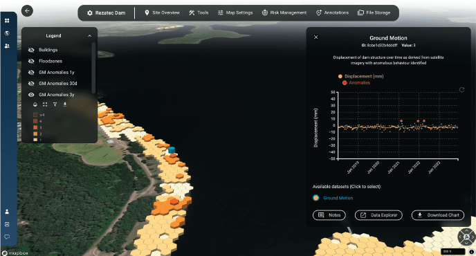
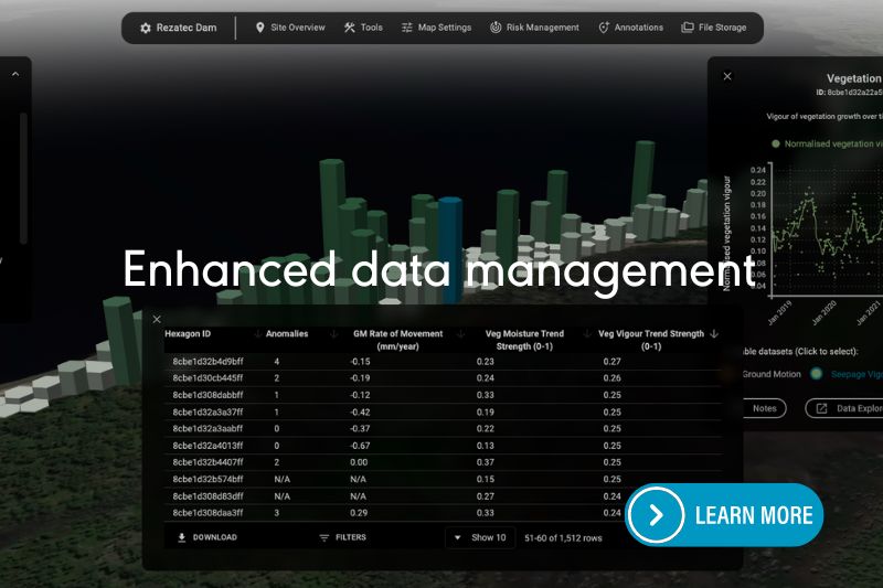
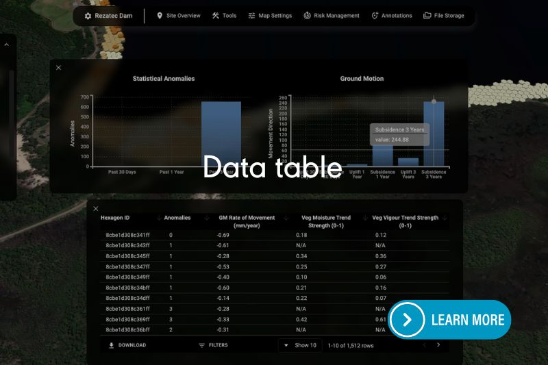
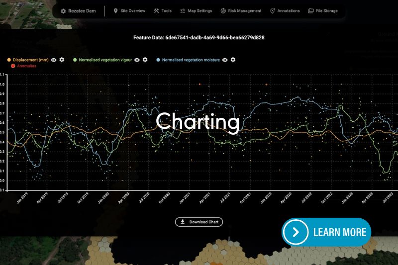
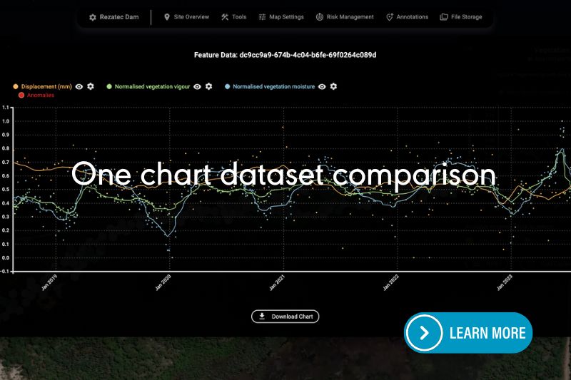
Transform the way you manage and analyze data with innovative features designed to streamline your processes and deliver deeper insights. Our advanced vegetation data processing allows you to quickly spot changes and trends, helping you make faster, more informed decisions. And by comparing multiple datasets in one clear, interactive chart, you can easily uncover connections between ground motion and vegetation health, providing you with a more comprehensive understanding of your environment. 

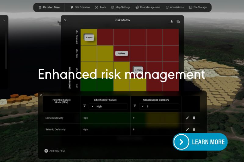
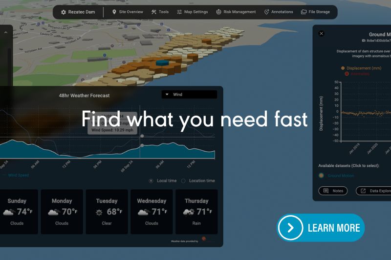
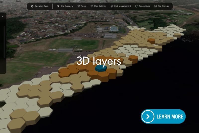
Managing dam data is now simpler and more efficient, with all the information you need at your fingertips. Instantly access comprehensive site details, analyze key data, and explore your sites in 3D for better context and clarity. These intuitive tools enable you to take a proactive approach to risk management by visualizing potential failure risks and staying on top of mitigation efforts. With the ability to assign tasks and track progress, you can ensure that your team stays aligned and actions are completed efficiently.  

Watch the videos to experience the power of streamlined data management and risk-informed decision-making. 

    dam monitoring platform
    Enhanced risk management
    Enhanced data management
    dam monitoring platform
    Find what you need fast
    Charting
    3D layers
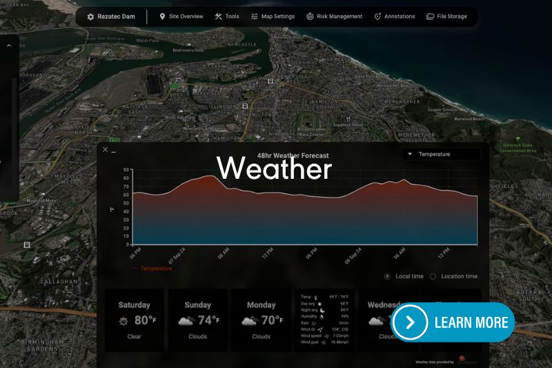
    Weather
    One chart dataset comparison

    Advanced Analytics at Your Fingertips

    Rezatec’s user-friendly, secure, web-based geospatial platform makes accessing and analyzing your pipeline risk data straightforward and effective. Gain detailed insights through interactive visualizations and powerful analytical tools.

    • Interactive mapping and geospatial analysis
    • Real-time data filtering, sorting, and summarization
    • Collaborative communication through built-in messaging and alerts
    • Integration of external datasets such as seismic, weather, and wildfire information
    • And more… 
    dam monitoring platform

    Harness Machine Learning

    Rezatec leverages advanced machine learning algorithms, trained specifically on your network’s historic failure data to deliver the most accurate pipeline failure predictions available. The model combines the network data e.g. age, material etc with environmental datasets and identifies the signature of failure for that specific network. This means each utility benefits from tailored predictions, uniquely suited to local conditions and asset characteristics. 

    Geospatial Intelligence

    Rezatec visualises data geospatially to provide new insights for utility leaders. It integrates diverse geospatial datasets—including satellite radar, optical imagery, soil characteristics, environmental factors, and infrastructure conditions—to provide a more accurate failure prediction, to map the consequences of that failure and to pick up what more traditional methods often miss. These insights put Rezatec’s customers ahead of the curve for proactive network management. 

    Explore Our Insights on Geospatial Analytics

    Rezatec’s geospatial analytics: Predicting risk of failure to drive proactive water network management

    Rezatec’s Geospatial Analytics platform uses artificial intelligence (AI) analytics and satellite, environmental, and historic network data to help water utilities predict the sections of pipeline networks that are most likely to fail with unprecedented accuracy,...

    WaterOne: Validating the accuracy of geospatial analytics

    Overview Founded in 1957 as an independent, non-profit public water utility, WaterOne is the largest utility in Kansas, serving 17 cities across Johnson County. With a mission to provide a safe, reliable, high-quality water supply with exceptional service and value,...

    Eden Prairie: Driving water distribution network improvements with geospatial analytics

    Overview The City of Eden Prairie sits 12 miles southwest of downtown Minneapolis in the State of Minnesota, United States. With a population growing to just over 64,000, the City has been recognized as a great place to work and raise a family for many years and is...

    Rezatec Partners with Agforest to Tackle Water Challenges Facing Spanish Utilities

    Rezatec has partnered with Agforest, a geospatial analytics company, to extend its precision geospatial AI platform to water utilities managing distribution and sewage networks in the Spanish market. This collaboration enables Spanish water utilities to benefit from...

    Developing a Risk-Based Digital Asset Planning Tool for Water / Wastewater Networks

    Written by Paul Davis & Cameron Jessup, BetterAIM; Rachael Lyon, Mackay Regional Council; and Marcus Holland, Rezatec Abstract Asset class strategies and plans are an integral component of asset-intensive organisations. However, while these plans and strategies...

    Texas Water Utilities Uses Geospatial Analytics Technology Powered by Rezatec

    Texas Water Utilities has extended its use of Rezatec’s Geospatial Analytics platform to monitor a total of almost 900 miles of distribution pipeline network. This Texas-based water utility is leading the way in adopting innovative new technology to help managers and...

    Not all geospatial AI is equal: 7 steps to finding the right pipeline risk tool

    With water companies coming under pressure to cut losses they are turning to new digital tools that can make leak prevention proactive. But with different products available, the key to success is choosing the right one. Were any reminder necessary, the unprecedented...

    Saving water in severe heat – How Geospatial Analytics can reduce pipeline network failure

    At Rezatec, we are used to reporting on the amount of water lost from pipeline networks. In webinars, media articles and case studies, we frequently highlight the number of swimming pools that could be filled as a result of pipeline breaks in the US (approximately...

    OPEX efficiency: How are pipelines monitored using Geospatial Analytics to cut costs?

    Saving water often comes up in conversation as something the general public should take responsibility for. In reality, however, there is a much bigger problem to address – the loss of non-revenue water. It’s estimated that between 20 and 50 percent of water is...

    How to navigate Satellite and AI technologies: five key questions for water utility leaders

    Join us for this session where we explore the five key questions water leaders need to ask when evaluating remote satellite and AI technologies to drive their shift from reactive to proactive network management.  With water utilities benefiting from big...

    Speak to us today

    Our team is here to answer your questions. We’re excited to help you explore how geospatial analytics can support your business. Just fill out the form and we’ll get back to you.