Rezatec Solutions
Other Geospatial Solutions
Geospatial analytics for business decision makers. Helping you reduce risk, optimize performance and meet regulatory requirements simply.
Expanding the Power of Geospatial Analytics
Organisations across energy, infrastructure, and natural resources face growing pressure to manage risk, operate efficiently, and stay compliant in an increasingly complex environment. Ageing assets, climate impacts, and tightening regulations add further challenges, while traditional monitoring approaches often lack the accuracy or scale needed to keep up.
Rezatec’s specialist geospatial solutions are designed to close this gap. We provide insights tailored to our customer’s use of the data, that utilize complex satellite and data science but make it easy to use and understand. This makes it easier to our users to anticipate issues earlier, allocate resources more effectively and make faster, data-driven decisions.
EUDR Compliance Solutions
Stay compliant. Reduce supply chain risk. Protect forests.
The EU Deforestation Regulation requires proof that commodities are deforestation-free. Rezatec’s solution tracks land-use types, monitors forest change, and delivers evidence to support compliance and due diligence.
Key Benefits:
- Detect and track deforestation and land-use change
- Assess sourcing-area risk for compliance
- Provide evidence for EUDR due diligence reporting
InSAR for Infrastructure Monitoring
Detect movement. Safeguard assets. Improve resilience.
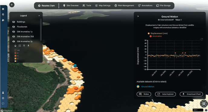
Infrastructure is vulnerable to subtle ground and structural shifts. Traditional surveys are limited in scale and frequency. Rezatec’s InSAR analytics detect millimetre-level displacement over time and measures from the sensor with a set orbit rather than from the changing earth’s surface, giving more accurate measurements. This helps operators safeguard assets and plan with confidence.
Key Benefits:
- Identify structural and ground displacement at scale
- Monitor changes over time with time-series analysis
- Integrate insights into asset management systems
Oil & Gas Infrastructure Monitoring
Protect assets. Reduce risk. Optimise resources.
Pipeline and infrastructure face constant threats from subsidence and environmental change. Traditional inspection is costly and reactive. Rezatec’s solution delivers portfolio-wide intelligence to detect movement and prioritise high-risk areas — supporting safer operations and efficient resource use.
Key Benefits:
- Detect subsidence and heave across pipeline corridors and tank farms
- Focus inspections where they are most needed
- Support integrity management and regulatory compliance
Solar Panel Monitoring
Detect movement. Safeguard assets. Improve resilience.
-
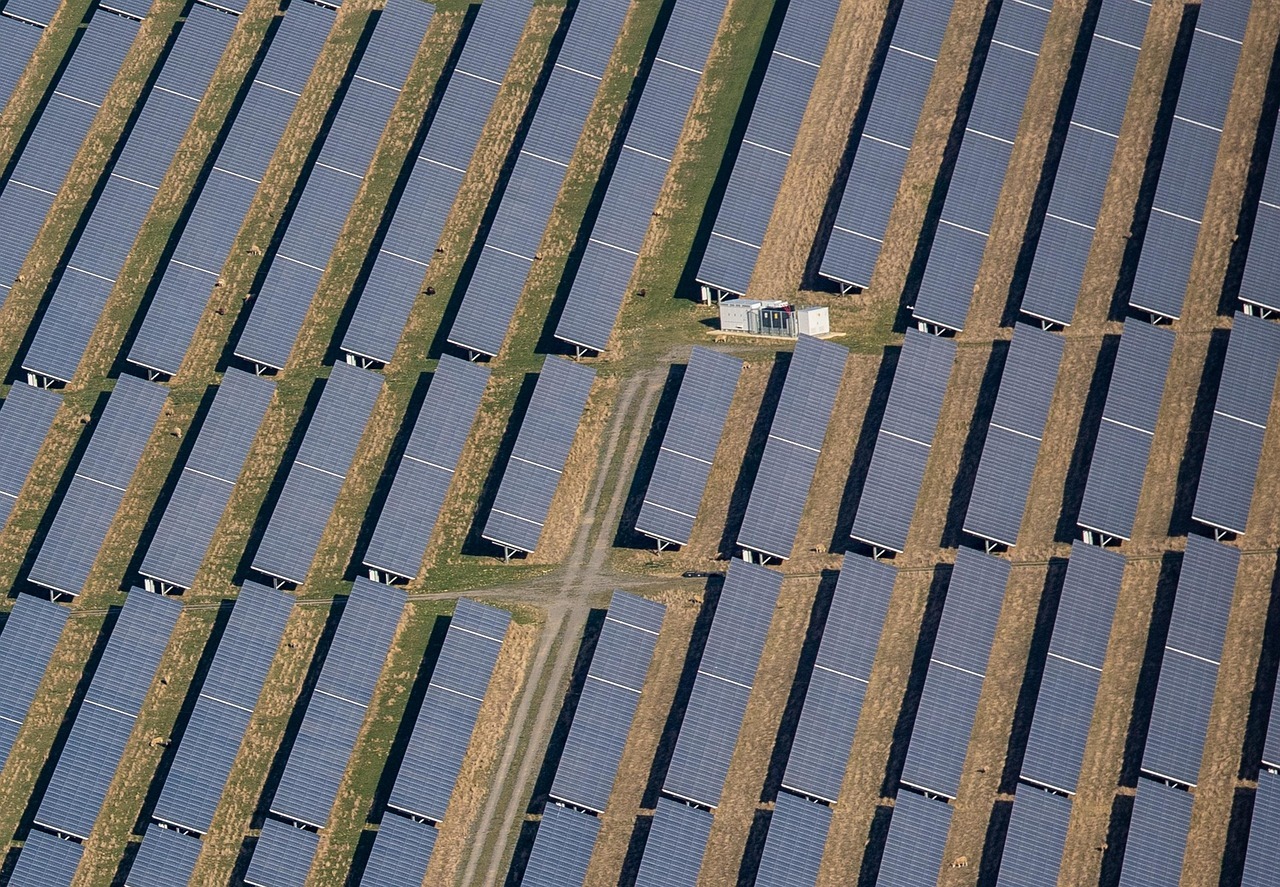
Solar farms lose output from damaged, tilted, or shaded panels. Manual inspections are time-consuming and miss issues at scale. Rezatec’s analytics provide remote, portfolio-wide monitoring to highlight ground movement and installation progress while maximising ROI.
Key Benefits:
- Detect ground movement and changes that may impact performance
- Benchmark performance across multiple sites
- Monitor installation projects
Why Choose Rezatec?
Rezatec delivers scalable, reliable and actionable geospatial analytics solutions that drive superior asset management. Trusted globally, Rezatec empowers organizations to manage risk for better resiliency, prioritize resources for greater efficiency and maintain asset integrity for operational excellence.
Unmatched Scale
Monitor assets across vast and remote areas
Independent Intelligence
Reliable, repeatable, and regulator-friendly
Actionable Insights
Turn complex data into clear decisions
Enhanced Collaboration
Seamlessly integrate with existing systems and workflows
Trusted Globally for Natural Asset Management
“New Forests requires accurate and precise forest inventory to quantify climate benefits from managing forests sustainably. Rezatec’s platform provides improved efficiency in field data collection, resulting in timely, accurate and spatially resolved results that meet our due diligence and business development needs.”
Peter Tittman, Investments Analytics Manager, New Forests.
“I was proud to lead this project and bring AI/ML solutions to WaterOne in an effort to advance our asset management and infrastructure planning programs. Rezatec was the ideal vendor for this pilot program and I’m pleased to say it was a resounding success!”
– Jason Beyer, GIS Lead, WaterOne
“Rezatec are continuously improving the Dam Monitoring solution and I’m impressed with these latest enhancements which are driving us in the way we use data and what to focus on. At Hunter Water we are confident we are doing everything in our power to exceed regulatory requirements and safeguard our dams and the surrounding population.”
Dan Turnbull, Dam Safety Engineer, Hunter Water
Advanced Analytics at Your Fingertips
Rezatec’s user-friendly, secure, web-based geospatial platform makes accessing and analyzing your pipeline risk data straightforward and effective. Gain detailed insights through interactive visualizations and powerful analytical tools.
- Interactive mapping and geospatial analysis
- Real-time data filtering, sorting, and summarization
- Collaborative communication through built-in messaging and alerts
- Integration of external datasets such as seismic, weather, and wildfire information
- And more…

Harness Machine Learning
Rezatec leverages advanced machine learning algorithms, trained specifically on your network’s historic failure data to deliver the most accurate pipeline failure predictions available. The model combines the network data e.g. age, material etc with environmental datasets and identifies the signature of failure for that specific network. This means each utility benefits from tailored predictions, uniquely suited to local conditions and asset characteristics.
Geospatial Intelligence
Rezatec visualises data geospatially to provide new insights for utility leaders. It integrates diverse geospatial datasets—including satellite radar, optical imagery, soil characteristics, environmental factors, and infrastructure conditions—to provide a more accurate failure prediction, to map the consequences of that failure and to pick up what more traditional methods often miss. These insights put Rezatec’s customers ahead of the curve for proactive network management.
Explore Our Insights on Geospatial Analytics

Speak to us today
Our team is here to answer your questions. We’re excited to help you explore how geospatial analytics can support your business. Just fill out the form and we’ll get back to you.


