Across North America, water utilities are grappling with a growing reality: aging pipeline networks are becoming both a service liability and a financial strain. With limited budgets and increasing pressure to maintain reliability, many teams still rely on field observations, pipe age, or worse — educated guesswork — to decide where to invest.
But as infrastructure ages and public scrutiny increases, intuition is no longer enough.
The Problem: Hidden Risk Beneath Our Feet
Buried networks don’t fail where it’s convenient — they fail where they’re least expected.
Traditional approaches to pipeline replacement often rely on:
- Historical failures and crew reports
- Basic GIS records and asset age
- Capital cycles versus actual risk
The issue? These methods leave utilities exposed to surprise failures, reputational risk, and repeated emergency spend. For many GIS and asset managers, the challenge isn’t knowing that risk exists — it’s knowing where it’s rising fastest.
The Shift: Data-Rich or Not, Utilities Need Actionable Risk Insight
Until recently, only utilities with perfect datasets could adopt advanced asset intelligence platforms. That left many organizations stuck — aware of rising risk but unable to act on it due to incomplete data or limited technical resources.
However, a major shift is happening.
Geospatial risk intelligence, powered by Earth Observation and machine learning, is giving utilities a new option: generate predictive risk insight even when datasets are imperfect.
That means pipeline risk can now be modeled, visualized, and prioritized without waiting for years of data cleanup.
Why Geospatial Risk Intelligence Is Becoming a Strategic Advantage
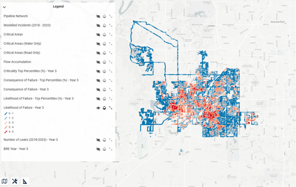
Modern risk platforms — like Rezatec’s Pipeline Risk solution — combine satellite-based ground movement monitoring with machine learning to:
- Detect environmental stressors not visible in GIS records
- Model failure probability at a pipe-by-pipe level
- Fill in missing data using historical patterns and derived metrics
- Present insights visually through existing GIS and mapping systems
This approach is transforming how utilities plan, justify funding, and communicate risk across departments and up to stakeholders.
Just like Olathe, KS, many utilities are discovering that when risk intelligence becomes defensible and data-backed, capital allocation increases — and confidence grows alongside it.
From Guesswork to Forecasting: What This Means for Utility Leaders
The industry is moving beyond reactive maintenance toward forecast-based, defensible decision-making. Utilities that adopt geospatial risk intelligence are seeing benefits such as:
- Smarter capital planning with clear prioritization
- Fewer emergency failures due to earlier intervention
- Faster funding approval backed by GIS-driven risk scores
- Improved data processes that reinforce long-term infrastructure strategy
In other words, the value isn’t just avoiding failure — it’s gaining control.
Want to See What Geospatial Risk Intelligence Could Uncover in Your Network?
Utilities no longer need perfect data to make smarter decisions. Rezatec enables GIS and asset leaders to turn scattered records into actionable risk models — helping them secure budget, plan proactively, and reduce uncertainty.
If your utility is still basing pipeline replacement on age or past failure — it’s time to see what predictive intelligence could reveal.
Explore Rezatec’s Pipeline Risk Solution to see how you can get ahead of failure before it happens.