
Overview
The North Carolina Department of Environmental Quality’s Dam Safety Program is responsible for overseeing a large and diverse dam portfolio across the state
As of mid-2026, the downstream hazard project included more than 7,450 dams and approximately 1,600 inundation zones across 76 of North Carolina’s 100 counties
Managing a portfolio of this size requires dam safety teams to maintain current, defensible information about downstream consequences while responding to changing development, extreme weather and limited staffing capacity.
North Carolina Department of Environmental Quality (NCDEQ)partnered with Rezatec to develop a scalable geospatial workflow that brings dam inventory data, inundation zonesand downstream infrastructure information into one centralized platform. The goal was to improve emergency response readiness, support hazard classification review and provide more current information for EAP updates.
The Challenges
Downstream conditions can change faster than traditional dam review cycles.
New homes, businesses, roads and other infrastructure may be added within or near inundation zones between formal inspections. While the physical condition of a dam may remain unchanged, the potential consequences of failure can increase as development expands downstream.
This gradual increase in exposure, known as hazard creep, can make recorded hazard classifications less representative of current conditions. During a storm, hurricane or potential dam incident, NCDEQ staff may also need rapid access to:
- Inundation boundaries
- Building locations
- Address information
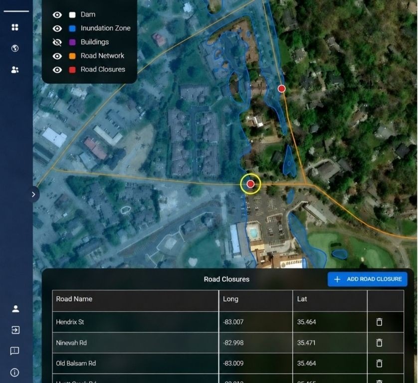
- Road networks and closure points
Historically, this information could be spread across multiple systems, maintained in static files or require significant manual effort to assemble.
The Solution
Rezatec integrated NCDEQ dam records, inundation zones, configured buffers, and supporting geospatial datasets within a single statewide platform. The workflow identifies buildings and associated addresses within inundation extents, maps road intersections and potential closure points, and links each output to the relevant dam, county, and hazard classification.
1. Mapped and tabular views
Users can move from a statewide overview to county- or criteria-specific subsets while keeping maps and tables aligned
2. Repeatable data refresh
Authorized users can upload new or refreshed inundation zones and rerun processing as dam inventories or downstream datasets change
3. Emergency Plan exports
Exports include dam records, inundation boundaries, address lists, road information and potential closure points. The resulting geospatial files, including user annotations, can be shared with local emergency management partners
4. Review Support
The workflow highlights where downstream exposure may warrant closer review while preserving engineering and regulatory judgment
The Results
Early implementation showed that the most immediate value was improved emergency response readiness and more consistent hazard classification review, particularly for high- and intermediate-hazard dams
Improved situational readiness
During 2026 preseason hurricane exercises, staff assembled inundation maps, structure information,road-access constraints and address data more efficiently than through the previous multi-system approach.
Consistent regulatory screening
NCDEQ retroactively reviewed five recent internal jurisdictional determinations. The platform outputs aligned well with the results produced through the more time-intensive manual method
Current, defensible information
Processing, upload, and classification dates improve audit-trail visibility and help staff understand how current each downstream record is
Better prioritization
Portfolio-wide screening helps identify where follow-up review, emergency planning or downstream data maintenance may be warranted.