
by Jordyn Hayden | Oct 22, 2025 | Articles, Forest Monitoring
Discover the key data insights driving smarter, more resilient forest establishment. Across the forestry sector, one challenge is shared by all: how to establish resilient, productive forests in a time of increasing constraint. Rising costs, limited labour, changing...

by Jordyn Hayden | Aug 11, 2025 | Articles, Forest Monitoring
Rezatec is proud to be featured in a recent FoodNavigator article, which explores how Earth observation data is playing a pivotal role in helping agri-food businesses comply with the EU Deforestation Regulation (EUDR). The regulation, which came into force in 2025,...
by Jordyn Hayden | May 28, 2025 | Case Studies, Pipeline Risk
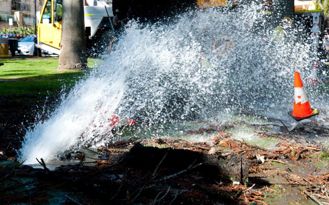
Overview The City of Olathe, located in Kansas, serves approximately 100,000 residents within its water system boundary, while the total city population is around 150,000. The city operates an extensive water distribution network, consisting of over 623miles of...

by Jordyn Hayden | May 6, 2025 | Case Studies, Pipeline Risk
Overview Founded in 1957 as an independent, non-profit public water utility, WaterOne is the largest utility in Kansas, serving 17 cities across Johnson County. With a mission to provide a safe, reliable, high-quality water supply with exceptional service and value,...

by Jordyn Hayden | May 6, 2025 | Pipeline Risk
Hear from Jason Beyer, GIS Lead at USA utility, WaterOne, who will answer the killer question: can I trust geospatial analytics and how do I make it work for my organization? Faced with a near $50 million upgrade bill over the next ten years spanning 2,800...